‘Wholly inadequate’: Climate group challenges Maple Ridge transit corridor plans
A Maple Ridge climate action group has serious concerns about the city’s active transportation plans – saying that what is proposed doesn’t go far enough to encourage people to cycle or walk.
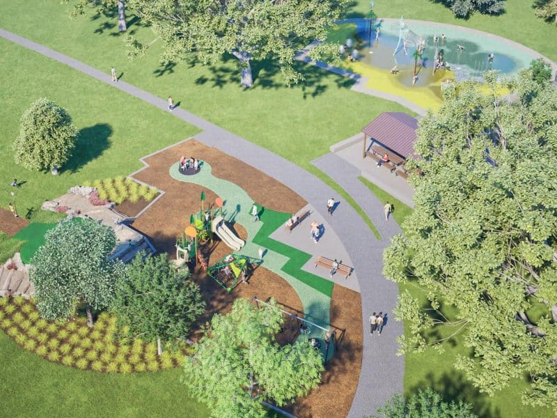
The city held a public hearing Tuesday night on the proposed updated Lougheed Transit Corridor Area Plan, a comprehensive framework to guide future growth along one of Maple Ridge’s most significant transportation corridors. The plan supports transit-oriented development focused on the neighbourhood around four future Bus Rapid Transit stations planned at 203 Street, 207 Street, Laity Street, and 216 Street as part of TransLink’s Langley–Haney Place BRT Line.
- The updated plan includes:
- The areas around BRT stations as mixed-use employment and housing.
- The West Ridge Greenway to better connect residents with nature.
- Active transportation infrastructure.
- Housing options for diverse needs.
- Safe, inclusive, and vibrant neighbourhoods.
The Maple Ridge Climate Hub, however, has a “major concern” about some design elements, according to Kirk Grayson, the group’s past president.
Grayson said the current plan for the West Ridge Greenway, which runs east-west through the corridor between Lougheed and Dewdney Trunk, calls for a single multi-use path on one side of the street for bicycles, mobility scooters, scooters/skateboards/e-bikes and pedestrians, and a sidewalk for pedestrians on the other side of the street. This same thoroughfare is designed to accommodate two lanes of traffic (one in either direction) plus on-street parking.
“Unfortunately this approach is wholly inadequate for the purpose of encouraging and supporting active transportation,” Grayson said. “A bi-directional multi-use path is OK in some circumstances, such as the one on Abernethy where there are virtually no pedestrians, cycling traffic is low, there are few intersections and fewer driveways. But in a vibrant urban environment such as that planned for the Lougheed Transit Corridor, a MUP is uncomfortable, inefficient, and unsafe for all users.”
What is needed, said Grayson, is a revised design that accommodates single-direction bike lanes on each side of the street for all users on wheels, physically separated both from pedestrians and car traffic.
“An updated design should also include pedestrian sidewalks, separate from bike paths and car traffic, on both sides of the street,” Grayson said.
Supporting Growth Near Transit
The updated Area Plan introduces revised guiding principles, land use policies, and designations that focus growth primarily near future BRT stations. These station areas are envisioned as mixed-use employment hubs, providing new housing, employment opportunities, and services and amenities within walking distance of rapid transit.
Additional policies address key City priorities, including:
• The West Ridge Greenway, enhancing green space and sustainable mobility
• Urban forestry and tree canopy expansion
• Climate action and resilience
• Mobility, arts, and culture
Updated Development Permit Area Guidelines will ensure new development contributes to a high-quality urban environment, with buildings and site designs that prioritize people, active transportation, and attractive streetscapes. Details on land use designations, applicable policies, design guidelines, and the application process are available at MapleRidge.ca/LTCAP.
Shaped by Community Engagement
The updated Area Plan reflects extensive public engagement from spring 2025, including open houses, a survey, mailed notices, digital outreach, and pop-up events. Over 200 attended open houses and 349 surveys generated more than 900 comments. Feedback showed support for long-term planning, improved access to local jobs, shops, and services near transit, balancing growth with livability.
Next Steps
The Public Hearing on January 20, 2026 will provide residents, property owners, and interest holders an opportunity to share feedback directly with Council before the bylaw is considered for third reading and adoption. For more information, visit Engage.MapleRidge.ca/LTCAP.
Lougheed Transit Corridor
The Lougheed Transit Corridor extends from Maple Ridge’s western boundary to the Town Centre at 221 Street along Lougheed Highway and Dewdney Trunk Road. As a gateway to Maple Ridge and the city’s Town Centre, this area has been identified as a regionally significant Major Transit Growth Corridor in Metro 2050, Metro Vancouver’s Regional Growth Strategy.
Author